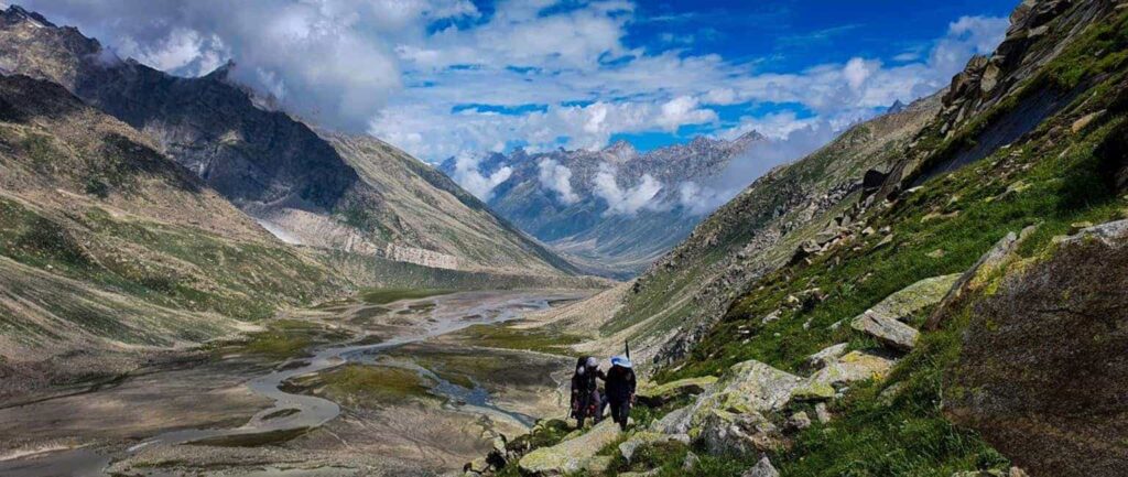
India is home to some of the highest mountains in the world, offering some of the most stunning and challenging treks for adventurers and thrill-seekers. Trekking in India is not only a test of endurance, but also a chance to explore the rich and diverse cultural and natural heritage of the country. In this article, we will explore the top 10 highest treks in India.
Scale New Heights With Top 10 Highest Treks In India
Top 10 Highest Treks in India To Visit
Kalindikhal Trek

The Kalindikhal Trekking Tour is an exciting adventure that includes a thrilling camping experience at the base of Shivling Peak. The hike also allows trekkers to see Gaumukh, the sacred Ganges River’s source.
The trek traverses half of Garhwal, beginning in the Bhagirathi Valley and ending in the Alaknanda Valley, via Nandanvan, which provides an unsurpassed view of the Shivlinga mountain.
After acclimatisation, the trekkers can ascend to Vasukital Lake, a beautiful camping spot surrounded by snow-capped peaks. The Kalindikhal Pass crossing begins with a difficult ascent across Sweta Glacier.
The Kalindikhal route eventually descends to Arwatal and Mana, the last village on the Chinese border. The tour concludes with a visit to the holy temple in Badrinath.
- How to reach Kalindikhal Trek? You can first reach Gangotri via Haridhwar or other connected cities then take a bus to this trek. At a distance of around 226 km from Gangotri is located the closest airport named Jolly Grant Airport.
- What is Kalindikhal Trek famous for? The KalindiKhal Pass Trek is one of Uttarakhand’s most arduous treks, but it is also well-known for its route to the holy Badrinath Temple.
- Best time to visit Kalindikhal Trek: The ideal time to embark on the Kalindi Khal Pass trek is from mid-June to early September, during the summer and monsoon season. This time of the year offers pleasant weather with clear skies, stunning views of the Himalayan range, and refreshing cool winds.
- What is the height of Kalindikhal Trek? 5946 kilometers
- What is the length of Kalindikhal Trek? The Kalindikhal Trek is approximately 90 kilometers long and typically takes around 15 days to complete.
- How difficult is Kalindikhal Trek? The Kalindikhal Trek is considered to be an extremely difficult trek as it involves long hours of walking and steep ascents and descents.
Goecha La Trek
The Goecha La Trek, located in the Indian state of Sikkim, is one of the most popular high-altitude treks in the country. The hike provides breathtaking vistas of some of the world’s highest peaks, including Mount Kanchenjunga, the world’s third-highest peak.
The trip begins in Yuksom and takes about ten days to complete. The trail winds through deep forests, magnificent meadows, and rocky terrain, crossing multiple high-altitude passes.
The Goecha La pass, at an elevation of 4,940 metres, is the trek’s highest point. As a result, we cannot leave this journey off our list of the top ten tallest treks in India.
- How to reach Goecha La Trek? First Rreach Bagdogra Airport or New Jalpaiguri Railway Station.The nearest airport and railway station to the Goecha La Trek are Bagdogra Airport and New Jalpaiguri Railway Station, respectively. From there take bus.
- What is Goecha La Trek famous for? Many trekkers dream of reaching Goechala, which offers breathtaking vistas of the Kanchenjunga Range, the world’s third-highest mountain range.
- Best time to visit Goecha La Trek: For those planning to embark on the Goecha La Trek, the recommended time to visit is during the autumn season which falls between September to November. This time of the year is considered ideal due to favorable weather conditions and scenic views.
- What is the height of Goecha La Trek? 4,940 meters
- What is the length of Goecha La Trek? The length of the Goecha La Trek can vary depending on the specific itinerary chosen by the trekker. Generally, the trek takes around 8 to 10 days to complete, covering a distance of approximately 90 to 100 kilometers.
- How difficult is Goecha La Trek ? It is a moderate trek but for newbies, it might be difficult.
Suggested reads: Discover The Top 10 Trekking Places In India
Tsomoriri – Spiti Valley Trek

The Tsomoriri-Spiti Valley trek is a difficult and spectacular trek in India’s Ladakh and Spiti areas. The trek takes you through some of the most inaccessible and beautiful scenery in the Indian Himalayas, such as high-altitude deserts, snow-capped peaks, and pure alpine lakes.
The most popular aspect of the trek is a visit to the stunning Tsomoriri Lake, one of the world’s largest high-altitude lakes. The journey begins at Rumtse, a hamlet around 70 kilometres from Leh.
It passes through some of the most spectacular scenery in the world, including the Changthang plateau, Kyagar Tso Lake, and the 5,600-meter-high Parang La Pass. The trek begins with a gentle ascent to high-altitude passes and ends with a precipitous descent to valleys.
- How to reach Tsomoriri-Spiti Valley Trek? First reach Leh. Leh is the main town in Ladakh and can be reached by air or road. The nearest airport is Kushok Bakula Rimpochee Airport in Leh, which is well-connected to major cities in India. Then take a bus to the trek.
- What is Tsomoriri-Spiti Valley famous for? Tsomoriri-Spiti Valley is famous for its breathtaking natural landscapes, ancient Buddhist monasteries, adventure tourism, Tibetan culture, and remote off-the-beaten-path experience.
- Best time to visit Tsomoriri-Spiti Valley Trek: Spiti is best visited during the summer months from March to June, as this period not only offers comfortable weather but also ensures fewer crowds.
- What is the height of Tsomoriri-Spiti Valley Trek? 5600 meters
- What is the length of Tsomoriri-Spiti Valley Trek? It can vary from 10 to 150 kilometers depending on the trails selected.
- How difficult is Tsomoriri-Spiti Valley Trek? It can vary from moderate to difficult depending on route and weather.
Auden’s Col Trek
Auden’s Col trip is a difficult and exciting trip in Uttarakhand, India’s Garhwal region. The trail is named for British geologist John Bicknell Auden, who found the high-altitude pass in 1935.
The journey begins in Gangotri, about 250 kilometres from Dehradun, and passes through various rural villages and high-altitude campsites, including Nala Camp, Rudugaira Base Camp, and Gangotri Base Camp.
The crossing of Auden’s Col Pass, which stands at 5,490 metres and is one of the highest passes in the region, is the climax of the trek. If you intend to visit this journey, you should plan ahead of time because the conditions might be harsh.
- How to reach Auden’s Col Trek? Dehradun is the nearest major city to the starting point of the trek. You can reach Dehradun by air, train or road from major cities in India.
- What is Auden’s Col Trek famous for? Auden’s Col Trek is famous for being a challenging high-altitude trek in the Indian Himalayas, known for its breathtaking mountain views, glaciers, and crossing a high pass at over 5,490 meters.
- Best time to visit Auden’s Col Trek: The best time to visit Auden’s Col Trek is during the summer months of May to June and the post-monsoon months of September to October.
- What is the height of Auden’s Col Trek? 5490 meters
- What is the length of Auden’s Col Trek? The length of Auden’s Col Trek is approximately 70 kilometers long.
- How difficult is Auden’s Col Trek? It is considered one of the most difficult treks in Uttarakhand that takes around 14 to 15 days to complete.
Get Exclusive Hotel Deals!

Shivling Base Camp Trek
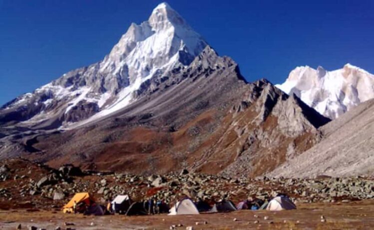
The Shivling Base Camp Trek is a difficult and spectacular trek in Uttarakhand, India’s Garhwal region. The journey begins in Gangotri, which is around 250 kilometres from Dehradun.
It passes through a number of rural communities and high-altitude campgrounds, including Bhojwassa and Tapovan. It is a popular trekking path, and you will encounter other trekkers along the way.
- How to reach Shivling Base Camp Trek? First you can reach Dehradun then to Gangotri. From there you can take a bus to this trek.
- What is Shivling Base Camp famous for? It is famous for the beautiful and serene lake located in Gaumukh.
- Best time to visit Shivling Base Camp Trek: For those intending to undertake the Shivling Base Camp Trek during the summer months, it is recommended to plan the trip between May and June. However, if visiting at another time of the year, it is advisable to schedule the trek between September and October, after the monsoon season has ended.
- What is the height of Shivling Base Camp Trek? 5263 meters
- What is the length of Shivling Base Camp Trek? It is around 15 to 20 km. The exact distance and duration of the trek may vary depending on the specific itinerary chosen by trekkers and the pace at which the trek is undertaken.
- How difficult is Shivling Base Camp Trek? The Shivling Base Camp Trek is considered to be a difficult and demanding trek in the Indian Himalayas.
Suggested reads: 18 Best Trekking Trips For Students To Must Try
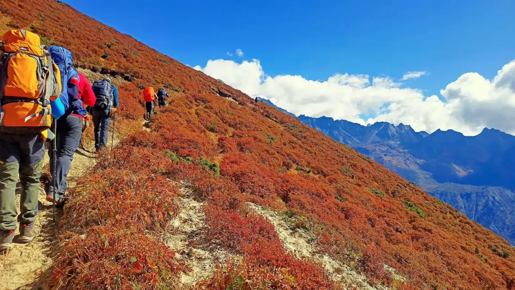
Pin Parvati Pass Trek
The Pin Parvati Pass is a difficult trip that rewards experienced hikers with a fantastic experience. The trek is long but rewarding, offering trekkers a large dose of adventure, natural beauty, and a sense of success.
The sensation of crossing a pass at 17,457 feet is simply unforgettable. The Pin Parvati Pass trek path is breathtaking, taking you through lush woods and verdant meadows of the Parvati Valley and Buddhist settlements in Spiti’s Trans-Himalayan region.
The stark contrast in landscapes, culture, plants, and fauna will captivate you. In just a few hours, you can go from the frigid, dry highland desert region of Spiti to the lush biodiversity of the Parvati Valley.
- How to reach Pin Parvati Pass Trek? Manali is the nearest major town to the starting point of the trek. You can reach Manali by road from major cities in India like Delhi and Chandigarh.
- What is Pin Parvati Pass famous for? It is popular for its route, landscape it covers and high difficulty.
- Best time to visit Pin Parvati Pass Trek: June to July is the best time to visit this trek.
- What is the height of Pin Parvati Pass Trek? 5,319 meters
- What is the length of Pin Parvati Pass Trek? The length of the trek to the summit and back is roughly 40 kilometers, and it usually takes around 8 days to complete the ascent and descent.
- How difficult is Pin Parvati Pass Trek? This trek is a very difficult trek.
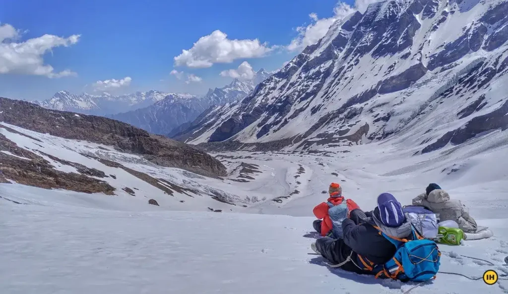
Panpatia Col Trek

The Panpatia Col trip in the Garhwal Himalayas is an exceedingly difficult and demanding journey that connects two prominent pilgrimage sites, Kedarnath and Badrinath.
This high-altitude pass is at an incredible height of 5260 metres between two peaks that tower over 5500 metres. The Panpatia Col hike is one of the least visited routes in the Indian Himalayas and is only suitable for experienced trekkers and mountaineers who are familiar with ice axes, crampons, and roping-up methods.
Because of the great degree of fitness necessary, it necessitates exceptional physical and mental endurance. The journey route passes past large glaciers, crevassed snowfields, steep moraines, and a 7-kilometer-long snowfield known as Panpatia, which is a treat for daring trekkers looking to complete this difficult trek.
The Panpatia Col Trek provides breathtaking views of numerous major peaks, including Nilkantha, Balakun, Hathi Parvat, and Dhauliganga.
- How to reach Panpatia Col Trek? You can first visit Haridwar, Bhadrinath or Joshimath then take bus to visit this trek.
- What is Panpatia Col Trek famous for? The Panpatia Col Expedition provides unrivalled views of major peaks like as Neelkanth, Balakun, Sri Parvat, Kunaling, Hathi Parvat, and Dhauliganga.
- Best time to visit Panpatia Col Trek: The best time to undertake this trek is during the summer months, from mid-May to June, and post-monsoon season, from September to early October.
- What is the height of Panpatia Col Trek? 5260 meters
- What is the length of Panpatia Col Trek? It is around 80 days that takes about 2 weeks to complete.
- How difficult is Panpatia Col Trek? The Panpatia Col trek is an extremely difficult and arduous trek.
Bhaba Pass Trek
The Bhaba Pass hike is a famous and somewhat difficult hike in Himachal Pradesh’s Kinnaur area. The crossing of the Bhaba Pass, at an elevation of 4,865 metres, is the pinnacle of the expedition.
The trek begins at Kafnu, about 200 km from Shimla, and passes via various rural communities and high-altitude campsites, including Mulling and Kara. The trek provides spectacular views of various peaks, including Shrikhand Mahadev and Kinner Kailash.
The trek takes about 6-7 days to complete and covers a distance of 40-50 kilometres. The trek begins with a gentle ascent to the high-altitude pass, followed by a difficult hike to the top. The descent from the pass is as difficult and necessitates excellent trekking abilities and expertise.
- How to reach Bhaba Pass Trek? The nearest major city to the Bhaba Pass Trek is Shimla, the capital city of Himachal Pradesh. Shimla is well-connected by road, rail, and air with major cities in India.
- What is Bhaba Pass Trek famous for? It is famous for its stunning views of snow-capped peaks, lush green valleys, and beautiful alpine forests.
- Best time to visit Bhaba Pass Trek: The best time to visit the Bhaba Pass Trek is from June to September, as during this time, the weather in Himachal Pradesh is mild, and the temperature typically ranges from 10°C to 20°C during the day.
- What is the height of Bhaba Pass Trek? 5319 meters
- What is the length of Bhaba Pass Trek? The length of the Bhaba Pass Trek is approximately 50 kilometers (round trip) and typically takes around 5-6 days to complete.
- How difficult is Bhaba Pass Trek? The Bhaba Pass Trek is considered to be a moderate to difficult trek.
Check Stay Options At
Bara Bhangal Trek

Bara Bhangal is one of Himachal Pradesh’s most remote settlements, and getting there requires a difficult trek over an ascending mountain pass that takes three to four days of trekking because there is no road going to the village.
The Shepherd hike is another name for the Bara Bhangal hike. It is a difficult and demanding trek, but the breathtaking landscape along the route makes it well worth the effort. This 11-night, 12-day journey is great for those looking for remote and picturesque trekking terrain.
The trek leads you across the glaciers of Bara Shingri and Indrasan, providing travellers with a unique and thrilling experience.
The journey begins in Manali and includes stops at Lama Dugh, Riyali Thach, Kalihani, Devi ki Marhi, Dal Marhi, Marhi, Plachak, Rajgundha, and, of course, Bara Bhangal. This hike is ideal for seeing the natural beauty and serene serenity of the area.
- How to reach Bara Bhangal Trek? The closest airport to Manali is Bhuntar, located approximately 50 km away from the town. To get to Manali, you can take a direct flight from Delhi to Bhuntar airport. From there, you can hire a taxi to reach the town of Manali.
- What is Bara Bhangal Trek famous for? Tourists know the Bara Bhangal Trek as trekking, high altitude trek, camping, and long trekking expedition.
- Best time to visit Bara Bhangal Trek: The best time to visit the Bara Bhangal Trek is from June to September, as during this time, the weather in Himachal Pradesh is mild, and the temperature typically ranges from 10°C to 20°C during the day.
- What is the height of Bara Bhangal Trek? 5260 meters
- What is the length of Bara Bhangal Trek? The length of the Bara Bhangal Trek is approximately 65-70 kilometers (round trip) and typically takes around 11-12 days to complete.
- How difficult is Bara Bhangal Trek? The Bara Bhangal Trek is considered to be a difficult trek.
Suggested reads: 10 Best Trekking Bags in India 2023
Stok Kangri Trek
Stok Kangri is an exceedingly difficult journey and one of the highest trekkable peaks in the world, towering at an elevation of 20,100 feet. It is higher than Europe’s tallest peak, Mt. Elbrus, at 18,510 feet, and slightly higher than Africa’s highest peak, Mt. Kilimanjaro, at 19,340 feet.
It is a sought-after location for adventure trekkers and is regarded as a treasured gem of India. The summit day of the Stok Kangri journey is the most difficult, requiring you to endure harsh sub-zero conditions, trek over a glacier for 6-7 hours at night, then trek on the ridgeline for two hours to reach the summit.
Although no technical experience is required, Stok Kangri is not a trek for beginners. Despite the difficulties, the panoramic view from the peak, which includes the Karakoram and Zanskar ranges, is stunning. The Stok Kangri trip is a once-in-a-lifetime journey and a trekker’s dream come true.
- How to reach Stok Kangri Trek? The nearest airport to Leh is Kushok Bakula Rimpochee Airport. Several airlines operate flights to Leh from major cities in India like Delhi, Mumbai, and Bangalore.
- What is Stok Kangri Trek famous for? It is famous for being one of the world’s highest trekkable peaks.
- Best time to visit Stok Kangri Trek The ideal time to plan a trip to Stok Kangri Trek is from May until mid-October, as this is when the climate in Ladakh is favorable, and the temperature typically ranges from 20°C to 30°C during daylight hours.
- What is the height of Stok Kangri Trek? 5242 meters
- What is the length of Stok Kangri Trek? It is about 40 kilometers which takes more than a week to complete
- How difficult is Stok Kangri Trek? It is a very difficult trek
This concludes our article on Scaling New Heights: The Top 10 Highest Treks in India for Adventurers and Thrill-Seekers. We hope you find this article useful and make sure to like, share and comment on this article.
You may also like 18 Best Trekking Trips For Students To Must Try.
FAQs (Freqeuntly Asked Questions)
Stok Kangri, at 20,190 feet, is India’s highest trekkable peak (6,154 m). It is also the tallest mountain peak in the Himalayan Stok Range in the Ladakh area of North India. It is considered India’s highest trek.
There are several treks in India that are considered to be challenging and difficult. Here are a few examples of the hardest treks in India:
1. Stok Kangri Trek in Ladakh, Jammu, and Kashmir.
2. Pin Parvati Pass Trek in Himachal Pradesh.
3. Rupin Pass Trek in Uttarakhand.
5. Goecha La Trek in Sikkim.
6. Nanda Devi East Base Camp Trek in Uttarakhand.
7. Kashmir Great Lakes Trek in Jammu and Kashmir.
8. Roopkund Trek in Uttarakhand.
9. Zanskar Frozen River Trek in Ladakh, Jammu, and Kashmir.
10. Markha Valley Trek in Ladakh, Jammu and Kashmir.
At 20,500 feet Stok Kangri is the highest trekkable summit in India (6,153 m).
Kalindi Khal is rightfully at the top of the list of the most demanding hikes. It is one of the world’s highest mountain passes, greater in altitude than four of the Seven Summits (a list of seven summits, the highest in each of the seven continents).
The highest trek in Maharashtra is the Kalsubai Peak trek, which stands at an elevation of 1,646 meters (5,400 feet) above sea level.
The Kedartal Trek is a popular trekking route in Uttarakhand, India, which takes you to the beautiful Kedartal Lake, located at an altitude of 4,912 meters (16,113 feet) above sea level. The trek is named after the lake and is one of the most scenic treks in the region.
Anamudi Peak is the highest mountain in the Western Ghats in South Asia, and it is located in Kerala. It stands around 8842 feet (2695 meters) above sea level. The area has also been dubbed the “Southern Himalayas.”
The top 10 highest treks in India are:
1. Kalindikhal Trek
2. Goecha La Trek
3. Tsomoriri – Spiti Valley Trek
4. Auden’s Col Trek
5. Shivling Base Camp Trek
6. Pin Parvati Pass Trek
7. Panpatia Col Trek
8. Bhaba Pass Trek
9. Bara Bhangal Trek
10 Stok Kangri Trek
Yes, you may need special permits for some of these top 10 highest treks in India, especially if they pass through protected areas or border regions. You can obtain these permits from the relevant authorities or through licensed tour operators.